Specimen Oct 26, 1992
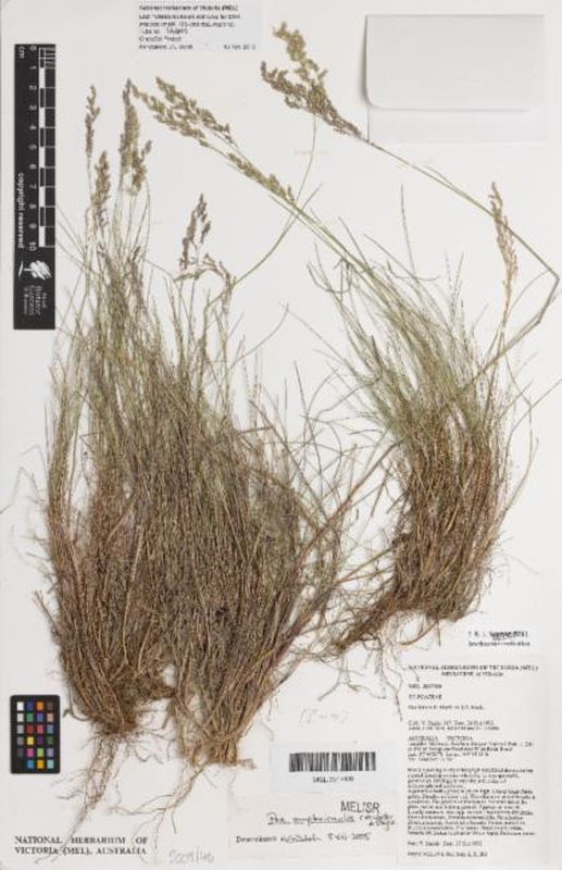
Poa amplexicaulis
AustraliaVictoriaMoorabool
Brisbane Ranges National Park. c. 250 m SW of Aeroplane Road turnoff on Reids Road.
Record
- GrSciColl institution
- 70fbf720-63a3-4e3c-b844-ee96091880e0
- GrSciColl collection
- 7777d910-553a-45ac-b0e5-635261c1e992
- Dataset
- National Herbarium of Victoria (MEL) AVH data
- Basis of record
- Preserved specimen
Taxon
- Scientific name
- Poa amplexicaulis
- Taxon concept ID
- https://id.biodiversity.org.au/taxon/apni/51442823
- Higher classification
- Eukarya | Plantae | Viridaeplantae | Streptophyta | Embryophyta | Tracheophyta | Spermatophytina | Angiospermae | Magnoliopsida | Poales | Poaceae | Poa
- Kingdom
- Plantae
- Phylum
- Charophyta
- Class
- Equisetopsida
- Order
- Poales
- Family
- Poaceae
- Genus
- Poa
- Specific epithet
- amplexicaulis
- Rank
- species
- Vernacular name
- Red-sheath Tussock-grass
- Nomenclatural code
- ICN
- Scientific name authorship
- C.M.Weiller & Stajsic
Poa amplexicaulis C.M.Weiller & Stajsic
KingdomPlantaePhylumTracheophytaClassLiliopsidaOrderPoalesFamilyPoaceaeGenusPoaSpeciesPoa amplexicaulis
- Taxon concept ID not found
Poa amplexicaulis C.M.Weiller & Stajsic
DomainEukaryotaKingdomPlantaeSubkingdomPteridobiotinaPhylumTracheophytaClassLiliopsidaOrderPoalesFamilyPoaceaeGenusPoaSpeciesPoa amplexicaulis
- Taxon concept ID not found
Location
- Location ID
- 895756f9-1abc-11e3-90a2-6c626d51f2da
- Continent
- OceaniaInferred
- Country or area
- Australia
- State province
- Victoria
- Locality
- Brisbane Ranges National Park. c. 250 m SW of Aeroplane Road turnoff on Reids Road.
- Verbatim locality
- Brisbane Ranges National Park. c. 250 m SW of Aeroplane Road turnoff on Reids Road.
- Decimal latitude
- -37.741
- Decimal longitude
- 144.304
- Coordinate uncertainty in metres
- 1,000Altered1000.0original
- Coordinate precision
- 0Altered2.777778E-4original
- Verbatim coordinate system
- degrees minutes seconds
- Verbatim SRS
- epsg:4326
- Geodetic datum
- EPSG:4326
- Verbatim latitude
- 37° 44' 29 S
- Verbatim longitude
- 144° 18' 15 E
- Location according to GADM
- AustraliaVictoriaMoorabool
Loading map...
Occurrence
- Occurrence ID
- 8ee18274-5371-421b-bd91-aaceacd2a470
- Catalogue number
- MEL 2017900A
- Record number
- 617
- Recorded by
- Stajsic, V.
- Clarke, I.C.
- Albrecht, D.E.
- Recorded by ID
- http://www.wikidata.org/entity/Q26714177
- http://www.wikidata.org/entity/Q8354093
- Sex
- Occurrence status
- Present
- Preparations
- Sheet
- Occurrence remarks
- Locally common. .
Other
- Record licence
- CC BY 4.0AlteredCC-BY 4.0 (Int)original
- Institution code
- MEL
- Institution ID
- Collection code
- MEL
- Collection ID
- Identifier
- 8ee18274-5371-421b-bd91-aaceacd2a470
- Modified
- 2023-01-21T09:08:13
- Rights holder
- Royal Botanic Gardens Board
- Type
- PhysicalObject
- GBIF ID
- 2438001144
Multimedia
- Format
- image/jpeg
- Identifier
- https://images.al...94e1-6d0be58ea6bc
- Creator
- Royal Botanic Gardens Victoria
- Record licence
- http://creativecommons.org/licenses/by-nc-sa/4.0/
Citation
- Please use this citation in publications
- Royal Botanic Gardens Victoria (2025). National Herbarium of Victoria (MEL) AVH data. Occurrence dataset https://doi.org/10.15468/rhzrxw accessed via GBIF.org on 2025-08-18. https://gbif.org/occurrence/2438001144
- API access
- Dataset
- National Herbarium of Victoria (MEL) AVH data
- Publisher
- Royal Botanic Gardens Victoria
- Last crawled
- 2025-08-08T01:04:34.846